Description
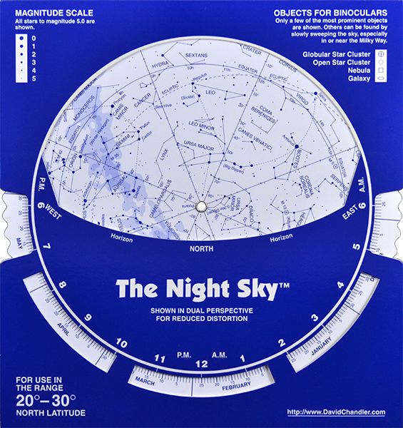
This economical version of The Night Sky chart contains the same low-distoriton two-sided map projection as our plastic planisphere but comes in a 8.5″ x 9″ cardboard format.
With instructions printed on the back for handy reference you will be locating constellations and select deep sky objects within minutes.
- Unlike coffee-table planispheres, The Night Sky is printed with dark stars on a light background, for easy nighttime readability.
- The constellations are drawn simply, emphasizing the brighter stars which makes them easy to recognize and locate with the naked eye or entry level equipment.
- Coordinate grid lines are shown without being intrusive. Coordinates are shown because they can be useful for cross referencing with star atlases.
- A selection of deep sky objects for binocular viewing is included. It is important to point out to beginners that the best first telescope is a pair of binoculars. You may already have what it takes to start observing tonight!
- The Night Sky is larger than it looks! The map scale is larger than on similar-size planispheres because the whole sky does not have to be shown on a single map.
Latitude Range
20° – 30° North Latitude
| Gewicht: | 50 g |
|---|---|
| Verlag: | Cordee |
| Medienart: | Karten |
| EAN: | 0721212000021 |
| Höhe in mm: | 250 |
| Breite in mm: | 210 |


Reviews
There are no reviews yet.